Fayoum
There are several ways to spell this city’s name in English, including Fiyum, El Faiym, and even Fayum. However, the city’s original name was Madnet El Faiym, which translates from Arabic to English as The City of Faiyum. The various spellings of the name may have referred to the city’s Oasis, but more often than not, the city itself is being described.
The current name, Al Fayoum, is adapted from the Coptic nomenclature ephiom/piom, which can be translated in English as the Sea or Lake; there is also a similar name in Egyptian, and these two refer to the nearby Lake Moeris. The name of an extinct species of ancient elephants, Phiomia, was also derived from the city name.The vast salty Lake Qarun comes into view less than two hours from Cairo, and the arid monotonous plains are replaced by a lush patchwork of farming plots, sunflowers swaying in the breeze, and tall date palms with water buffalo lounging in the shade beside them. Because of its location on one of Egypt’s largest canals, Al Fayoum has the hustle and bustle of any other urban Egyptian city. The city receives water from the Nile via a large number of artificially created capillary canals dug hundreds of years ago; it is because of these that the city is often referred to as an oasis. Because of the readily available water supply, the region is fertile and thus prosperous, with two reserve areas and parks, the Wadi Rayan National Park and the Lake Qarun Park. The City of Al Fayoum is also very appealing to archaeologists and Egyptian history buffs due to the presence of many ancient pharaohs’ palaces. A typical visit to Al Fayoum will include time spent in the village of Tunis, which is a settlement with a large collection of artworks. There’s also a lovely view of Lake Qarun’s beautiful shores. Fayoum is also a good starting point for excursions to the desert lakes of Wadi Rayyan and the prehistoric whale skeletons of Wadi Al Hittan.
EXPLORE. CONNECT. CREATE MEMORIES
Qarun Lake
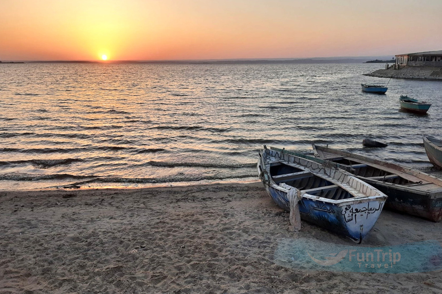
Lake Qarun is a popular weekend destination for Cairo residents looking to unwind, and the lake’s edge is lined with cafes and wedding pavilions. It’s not a large swimming hole, but the sight of a large lake on the outskirts of the desert is refreshing, and you can rent a rowing boat. The lake is now an important bird area, attracting thousands of migratory birds, including a large number of flamingos, during their winter migration south. Lake Qarun completely covered the area that is now known as Al Fayoum prior to the 12th-dynasty reigns of Sesostris III and his son Amenemhat III. In an early effort at land reclamation, both pharaohs dug a series of canals connecting Qarun to the Nile and drained much of the lake. Due to the diversion of the Nile to create more agricultural land over the last few centuries, the lake has regained some of its former grandeur, and it now stretches for 42 kilometres. However, because it is currently 45m below sea level, the water has suffered from increased salinity. Surprisingly, the wildlife has adapted, and the self-proclaimed “world’s most ancient lake” now supports a distinct ecosystem. There are numerous bird species to see here, especially in autumn, including a large colony of flamingos, grey herons, spoonbills, and many duck species.
Qasr Qarun
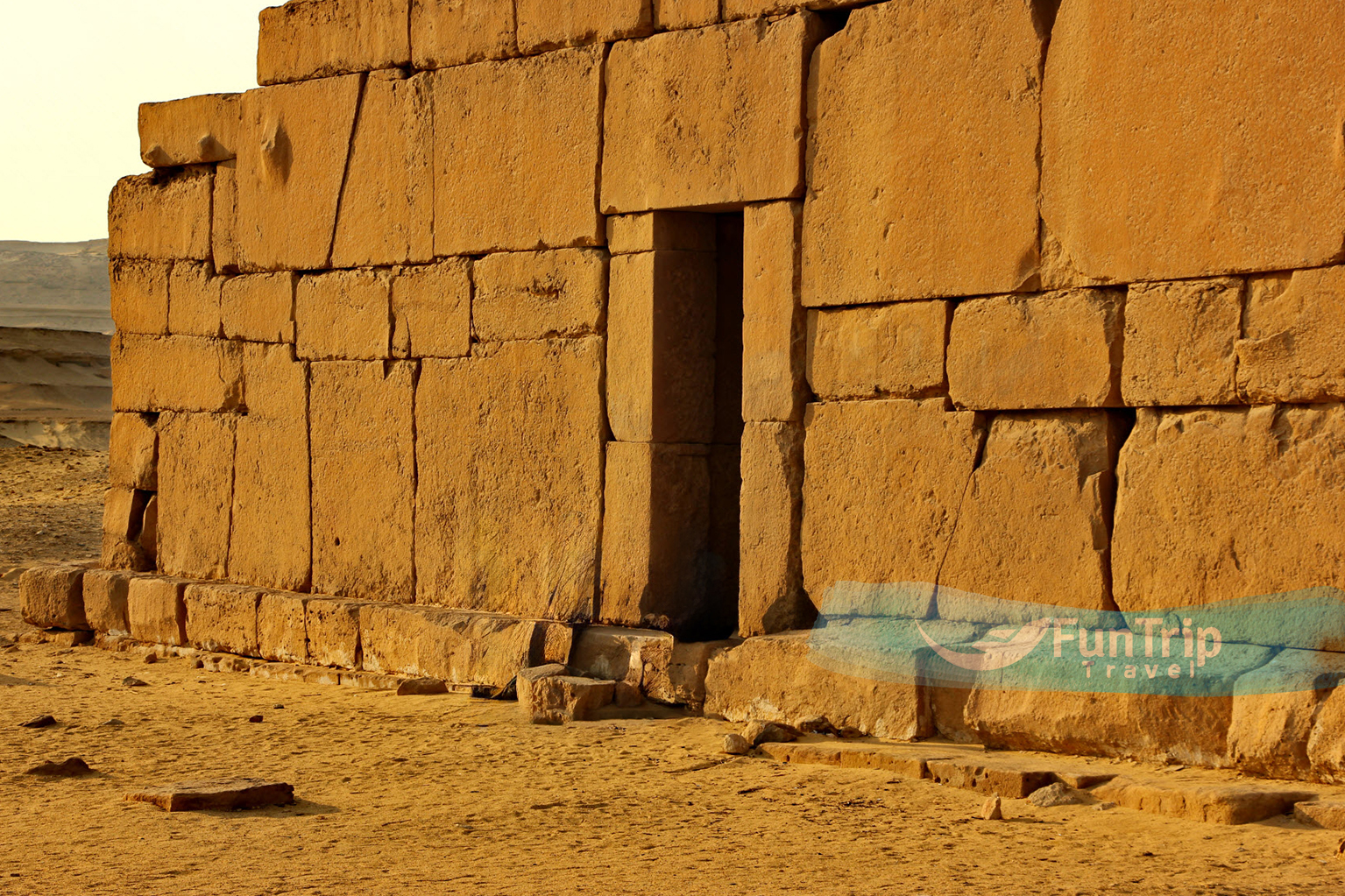
The ruins of ancient Dionysias, located at the western end of Lake Qarun, just east of the village of Qasr Qarun, were once the starting point for caravans to the Western Desert oasis of Bahariya. All that remains of the ancient settlement is Qasr Qarun, a Ptolemaic temple built in 4 BC and dedicated to Sobek, the crocodile-headed god of Al Fayoum. The rooftop offers spectacular views.
The temple is made of yellow limestone blocks, but there are no inscriptions except over the entrance, where there is a winged sun, and on the roof, where there is a headless relief of Sobek on the left and a king on the right. The internal structure has been strengthened; if you’re feeling brave, explore the incredible maze of chambers, tunnels, and stairways. Take a torch or candles with you.
Wadi Al Hitan
This Unesco World Heritage Site is home to the world’s oldest prehistoric whale fossils. The more than 400 basilosaurus and dorodontus skeletons discovered here are around 40 million years old and show the clear evolution of land-based mammals into sea-going mammals, as they have vestigial front and back legs.
The sands are also littered with the carcasses of manatees and large bony fish, which appear out of place in the vast desert.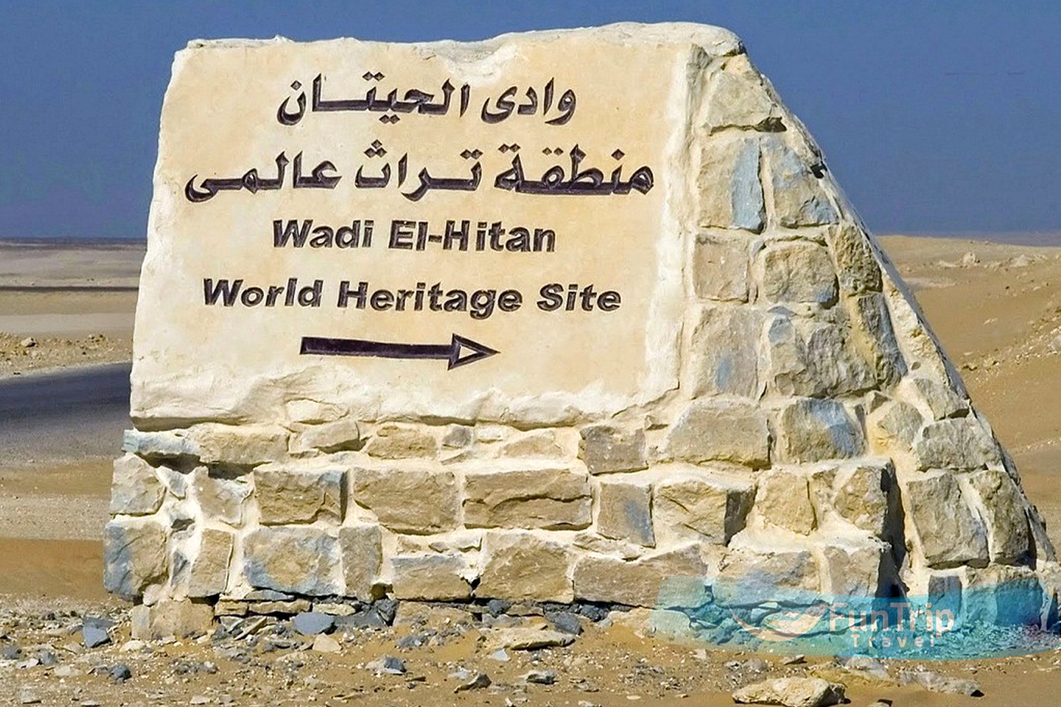
A small network of walking trails leads out from the central site complex to more than a dozen skeleton sites. Although it may not appear to be much, the desert setting is dramatic, and it’s a great day or overnight outing, usually combined with Wadi Rayyan.
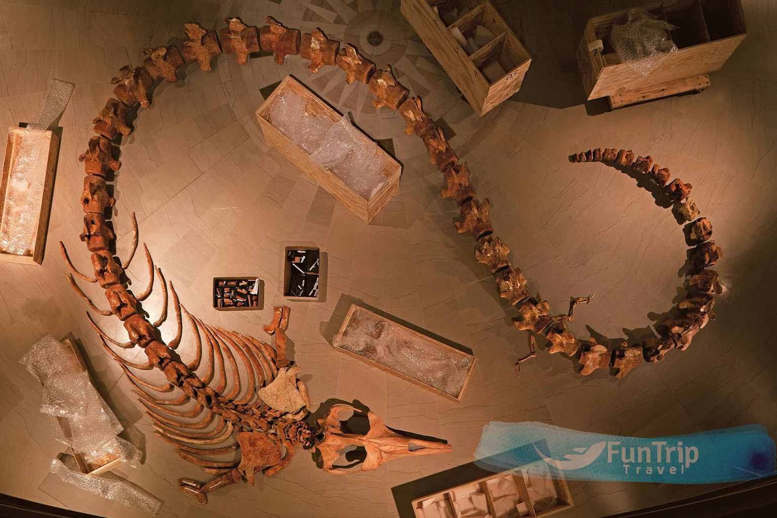
Toilets, a wilderness campground, and the excellent Wadi Al Hittan Fossil & Climate Change Museum are all part of the site complex. With a series of information boards and fossil displays surrounding the crowning exhibit, an 18-metre long skeleton of a Basilosaurus Isis whale, the circular one-room museum does a good job of explaining the geological history and nature of the area.
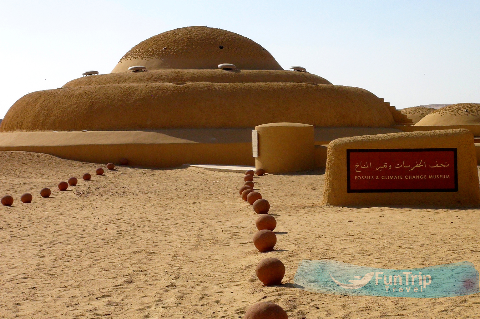
Wadi Al Hitan Fossil Museum
This circular one-room museum’s fossil displays and information boards do an excellent job of explaining the geological history, nature, and role of climate change in this area. The exhibits are arranged around the museum’s main attraction, an 18-metre-long skeleton of a Basilosaurus Isis whale.
Wadi Rayan Protectorate
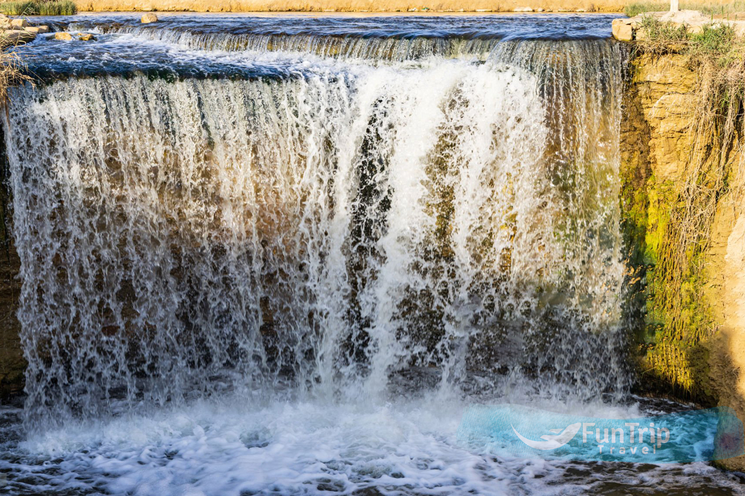
The ‘waterfalls’ in the Wadi Rayyan Protected Area are a popular weekend picnic destination for Cairo residents. The waterfalls are located about 20 kilometres from the reserve’s gate, on the left side of the road. A visitors centre, restrooms, and cafes are located along the lakefront. Big wooden rowboats take a one-hour trip out to the middle of the lake and then back up to the falls from here. The wider Wadi Rayyan area is teeming with wildlife, including white gazelles, Egyptian gazelles, sand foxes, and fennec foxes, as well as rare resident birds, migrant birds, and various eagles and falcons. It’s well worth delving deeper into this fascinating subject. Five kilometres past the lake turnoff is the rocky outcrop of Jabal Al Modawara, which is relatively easy to climb and a great place to spot eagles or falcons.
Karanis
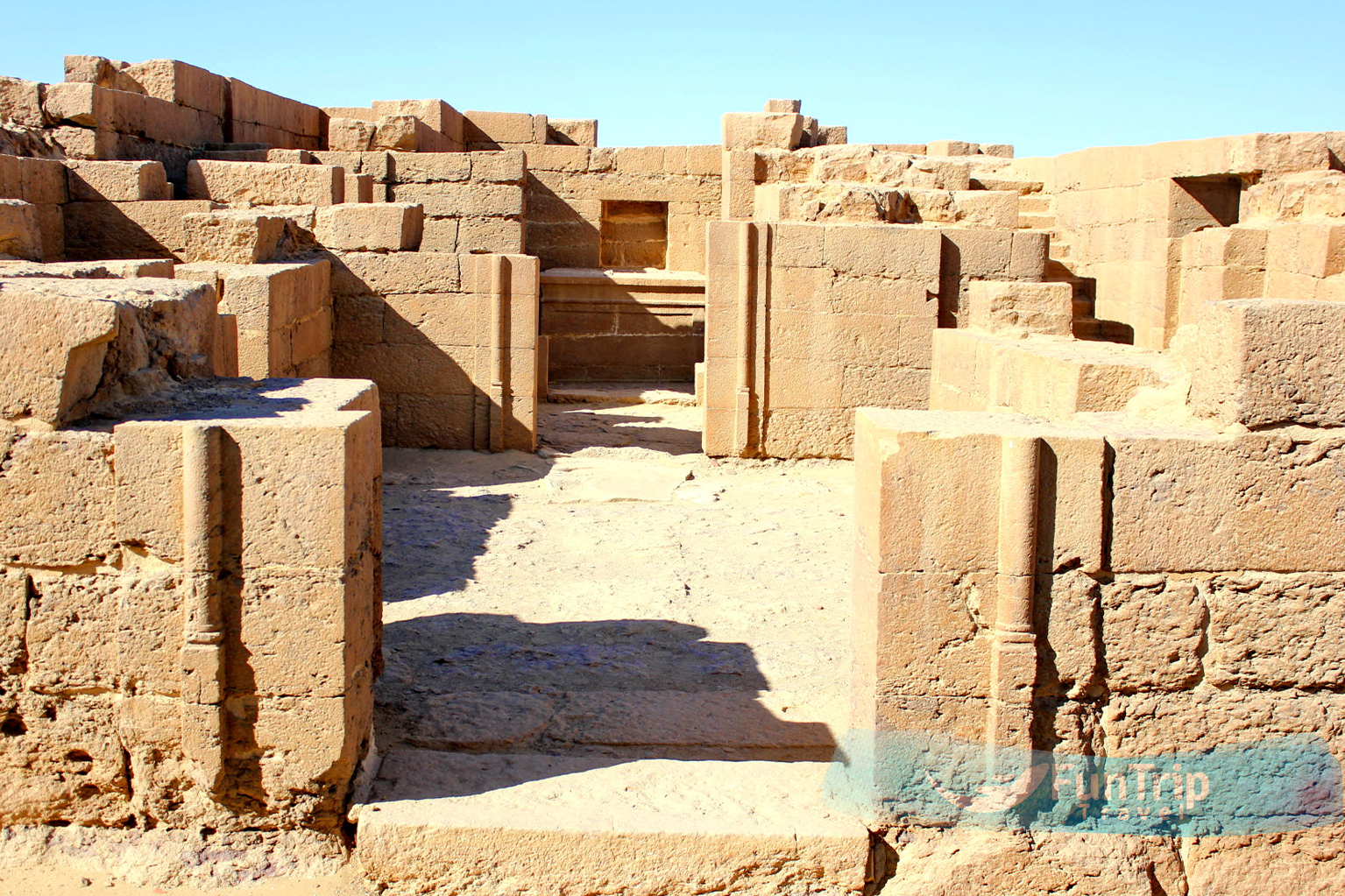
The sprawling ruins of ancient Karanis are located 25 kilometres north of Medinat Al Fayoum, on the outskirts of the oasis depression, along the road to Cairo. This was once a mudbrick settlement with a population of thousands, founded by Ptolemy II’s mercenaries in the 3rd century BC. Apart from half-buried, crumbling walls scattered across the sand, little of the ancient city remains intact today, though Karanis is home to two well-preserved Graeco-Roman temples. The larger and more interesting temple, dedicated to two local crocodile gods, Pnepheros and Petesouchos, was built in the first century BC. A large square container stands in front of the east entrance, serving as a giant swimming pool for the holy crocs. Inside, crocodile mummies would have been stored in wall niches, and the gods’ ‘house’ was a block-like structure. Inscriptions from the reigns of Roman emperors Nero, Claudius, and Vespasian adorn the temple as well.
It’s a long walk to the north temple, and there’s much less structure here – but there’s an ancient pigeon tower off to the east, not unlike the ones that dot Al Fayoum today. A frescoed bathtub can be found in the ruined domestic area north of the temple. The on-site museum, located next to Lord Cromer’s former field house, houses an eclectic collection of artefacts from Fayoum sites spanning the Pharaonic, Graeco-Roman, Coptic, and Islamic eras. A small open-air’museum’ of columns and stone statuary remnants rescued from Kiman Faris (ancient Crocodilopolis), which has been consumed by the modern city of Medinat Al Fayoum, is also located near the beginning of the ruins area. Because the site sign is only in Arabic and only labelled with its Arabic name, the best way to get here is by taxi. The driver (and anyone else in Fayoum) is also more likely to recognise the location by this name.
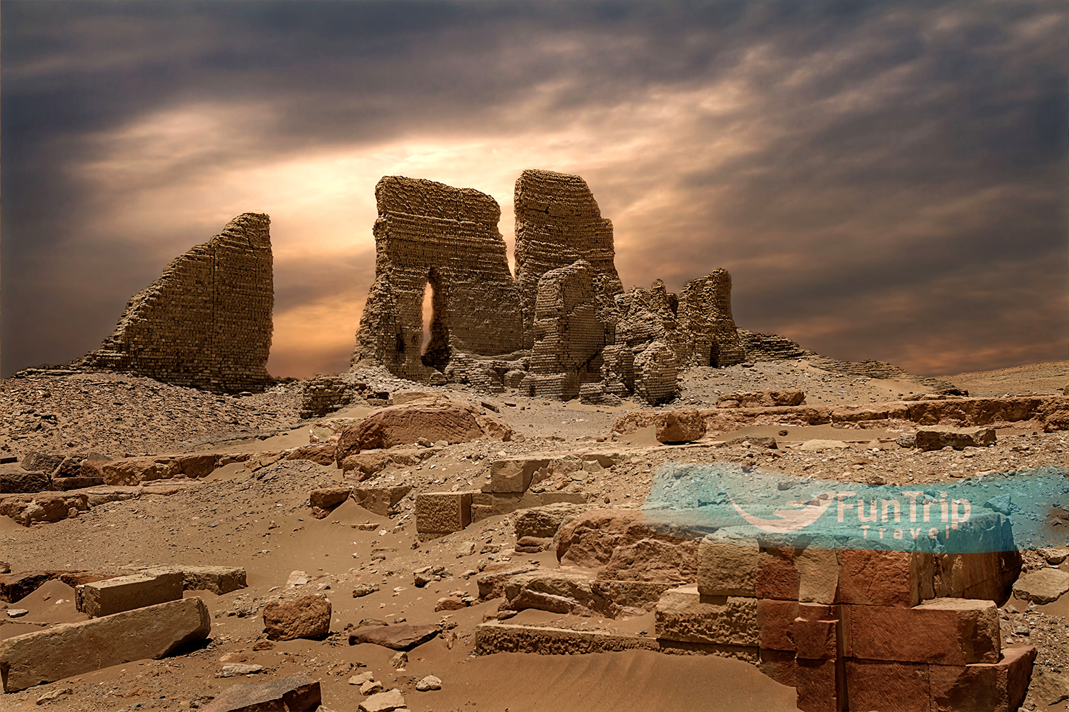
Medinet Madi
This ancient city is one of the most remote in Al Fayoum, but that adds to its allure, as you’re often alone out in the blowing sand that drifts over the stone sphinxes’ heads. Medinat Madi (Arabic for “City of the Past”) is known for its well-preserved Middle Kingdom temple, one of only a few in Egypt. It was built by Amenemhat III and Amenemhat IV and is dedicated to the crocodile god Sobek and the cobra goddess Renenutet. Excavations in Italy in the early twentieth century uncovered an archive of Greek texts referring to the city as Narmouthis. They also discovered a separate crocodile-cult temple, where the beasts appear to have been bred in captivity – a cache of eggs, as well as bodies of the creatures in various stages of development, were discovered. They were frequently sacrificed while still quite young.
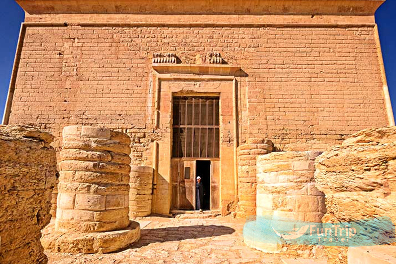
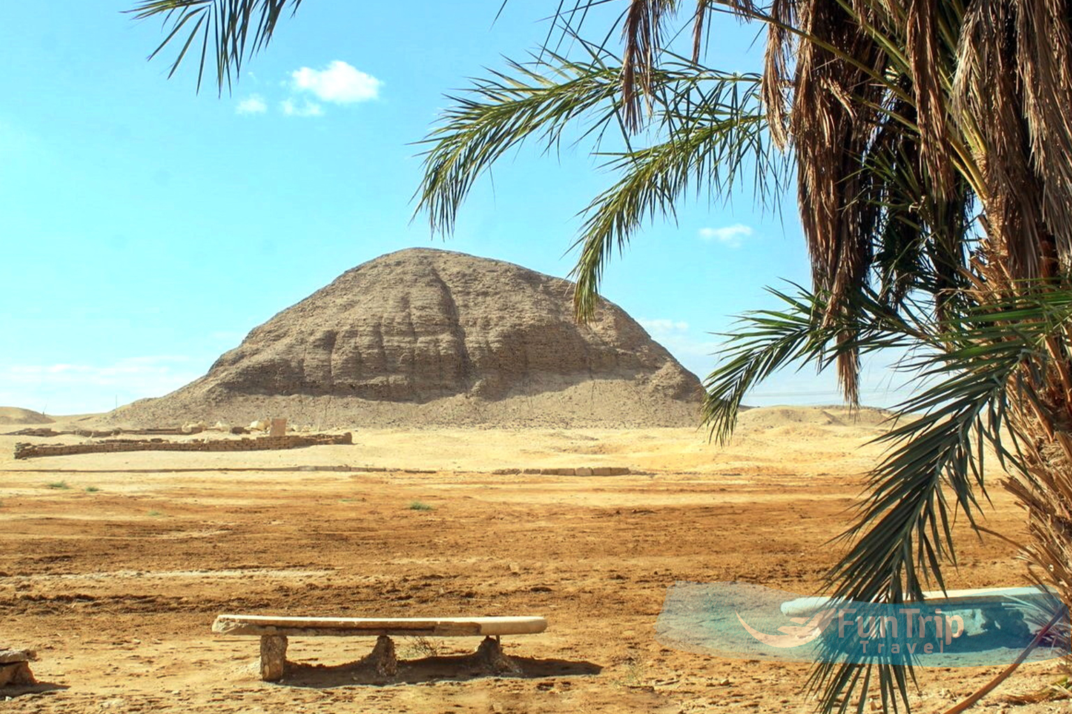
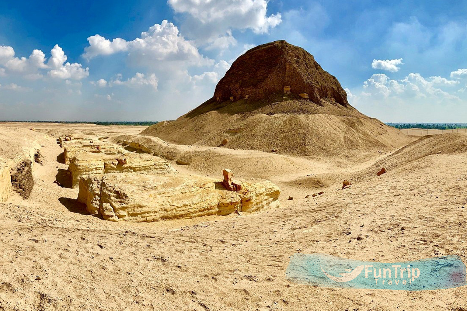
Pyramid of Hawara
The dilapidated second pyramid of Amenemhat III, built at a gentler angle than his first one, stands about 8 kilometres southeast of Medinat Al Fayoum, on the north side of the canal Bahr Yusuf, which connects Al Fayoum to the Nile (the towerlike Black Pyramid at Dahshur). This temple (300m by 250m) was described by Herodotus as a 3000 room labyrinth that surpassed even the Pyramids of Giza. Strabo claimed it had as many rooms as provinces. Despite the fact that the Pyramid of Hawara was originally covered in white limestone casing, only the mudbrick core remains today, and even the once-famous temple has been quarried. The interior of the pyramid, which is now closed to visitors, revealed several technological advances: corridors were blocked by a series of massive stone portcullises; the burial chamber is carved from a single piece of quartzite; and the chamber was sealed by an ingenious device that used sand to lower the roof block into place.
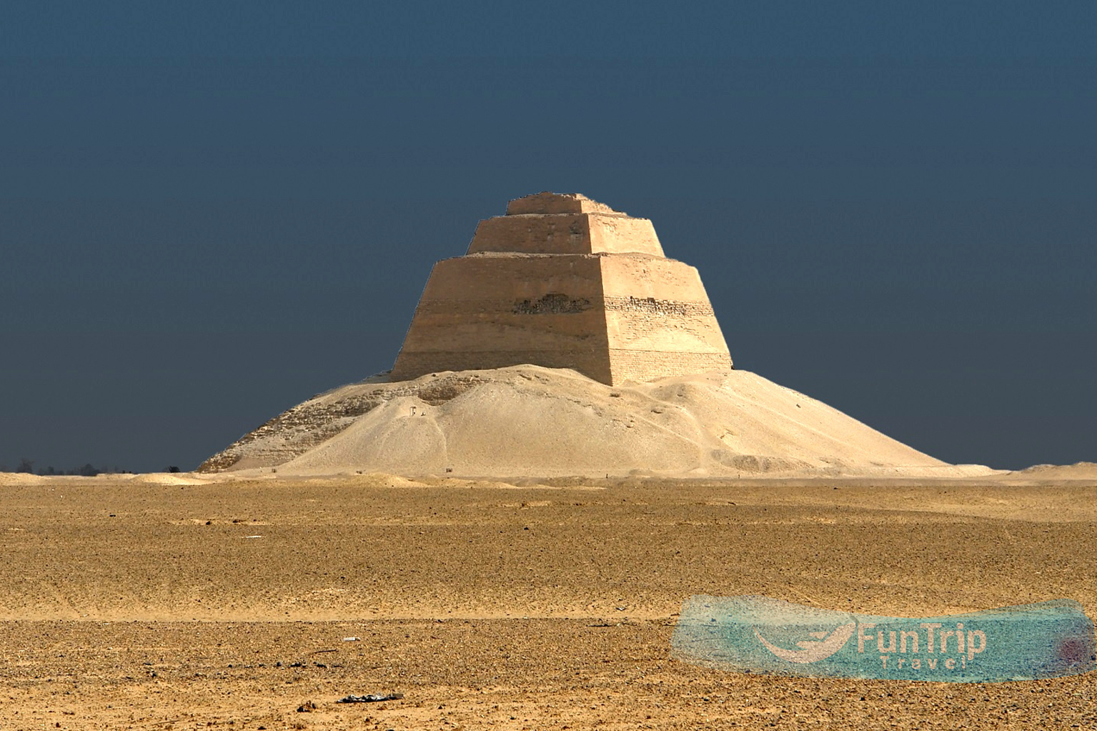
Meidum’s Pyramid
The ruin of the first true pyramid attempted by the ancient Egyptians is located about 30 kilometres northeast of Medinat Al Fayoum. It started as an eight-step structure, but the steps were later filled in and an outer casing was added to form the first pyramid shell. There were flaws in the design, and the pyramid’s own weight caused the sides to collapse sometime after completion (possibly as late as the last few centuries BC). Only the core remains today, but it is still an impressive sight.
Pharaoh Huni (2637-2613 BC) commissioned the pyramid, but his son Sneferu was in charge of its construction. Sneferu’s architects went on to construct Dahshur’s more successful Bent Pyramid and Red Pyramid.
The guard will unlock the pyramid’s entrance, from which steps lead 75 metres down to the empty burial chamber. The large mastaba tombs of some of Sneferu’s family and officials, including his son Rahotep and wife Nofret, are located near the pyramid.
The Pyramid of El-Lahun
The ruins of this mudbrick pyramid, built by Pharaoh Sesostris II, are located about 10 kilometres southeast of Hawara (1880–1874 BC).
Look for its oddly lumpy shape, which is set on an existing rock outcropping for added stature. Except for the amazing solid-gold cobra that is now displayed in the Egyptian Museum’s jewellery room (Room 4) in Cairo, ancient tomb robbers stripped it of all its rock and treasures.
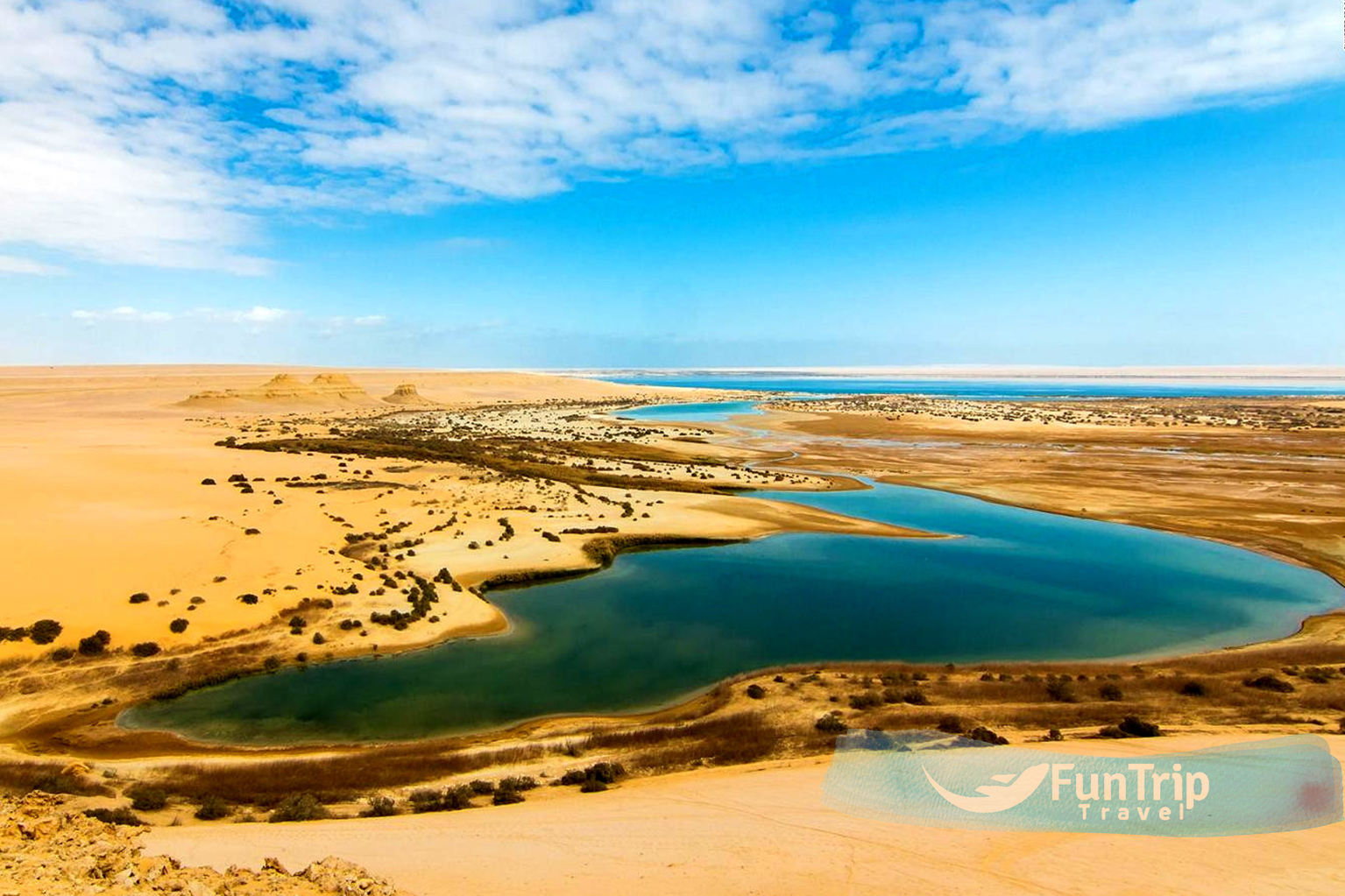
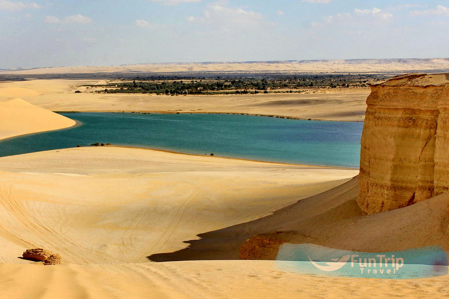
Magic Lake
The Magic Lake is one of Egypt’s most amazing lakes, offering stunning sunsets and people enjoy hiking, sandboarding, and swimming in it.
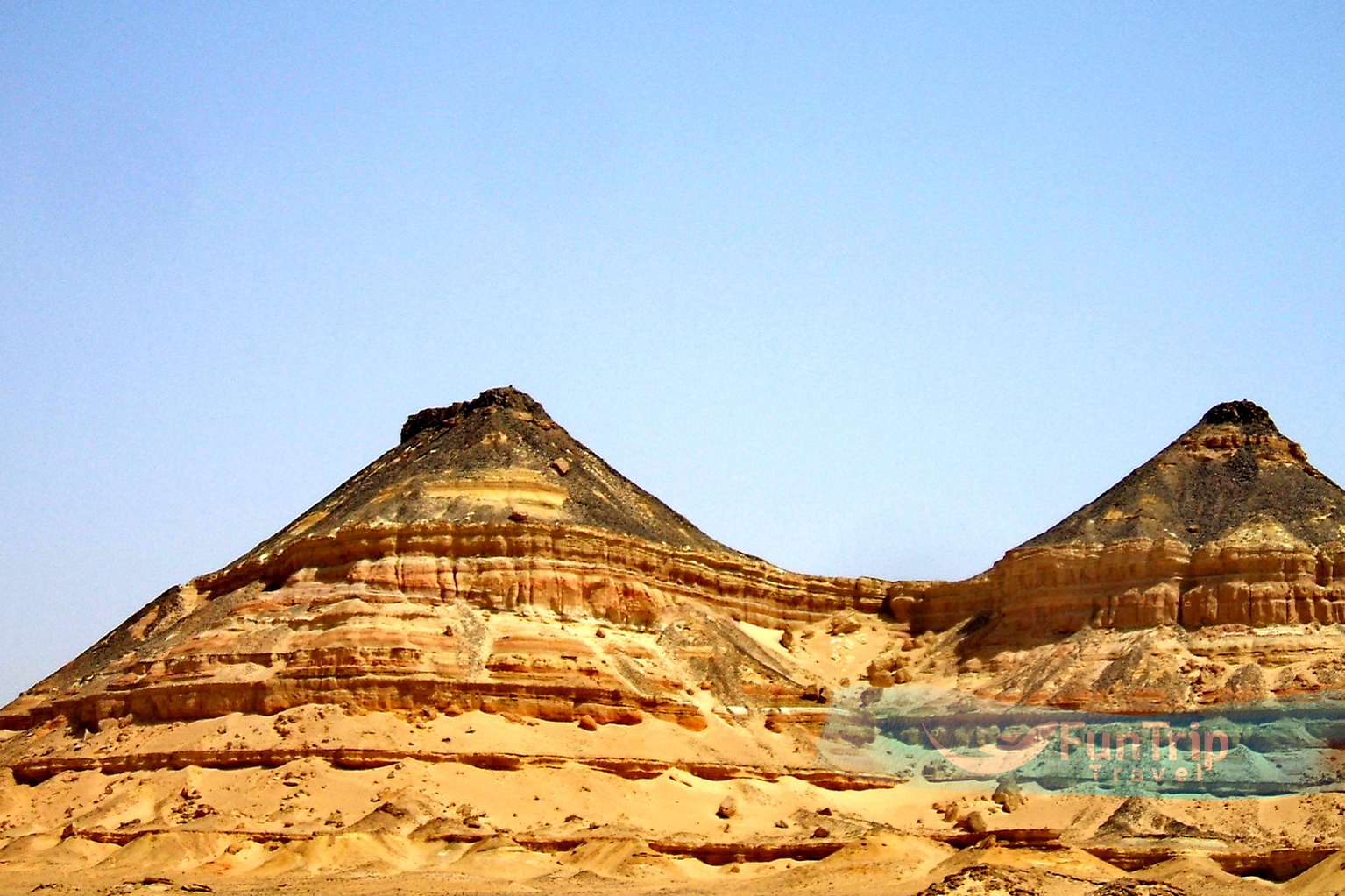
Mudawara Mountain (Jebel al-Mudawara), 90 m / 295 ft, is located west of Al Fayoum Lake. Although it is more of a rock formation than a true mountain, it has three distinct summits. Its layered appearance is beautiful, with a certain symmetry to the feature that draws your gaze.
Ghoroud Samuel, also known as the Samuel Dunes, is a section of land in the Egyptian Western Desert (part of the North African Sahara) that is mostly covered by sand dunes (Arabic: ghoroud) and is located between lakes and mountains. It has some of the most diverse fields of dune types close to Cairo and is suitable for off-roading clubs on a single day trip. This lovely sand dune area offers numerous opportunities for adventurers, cultural explorers, naturalists, spiritual seekers, and campers. Ghoroud Samuel is 45 kilometres south of Fayoum and averages 10 kilometres wide in an area entirely covered by dunes, with some infiltration by rocks and small plateaus.
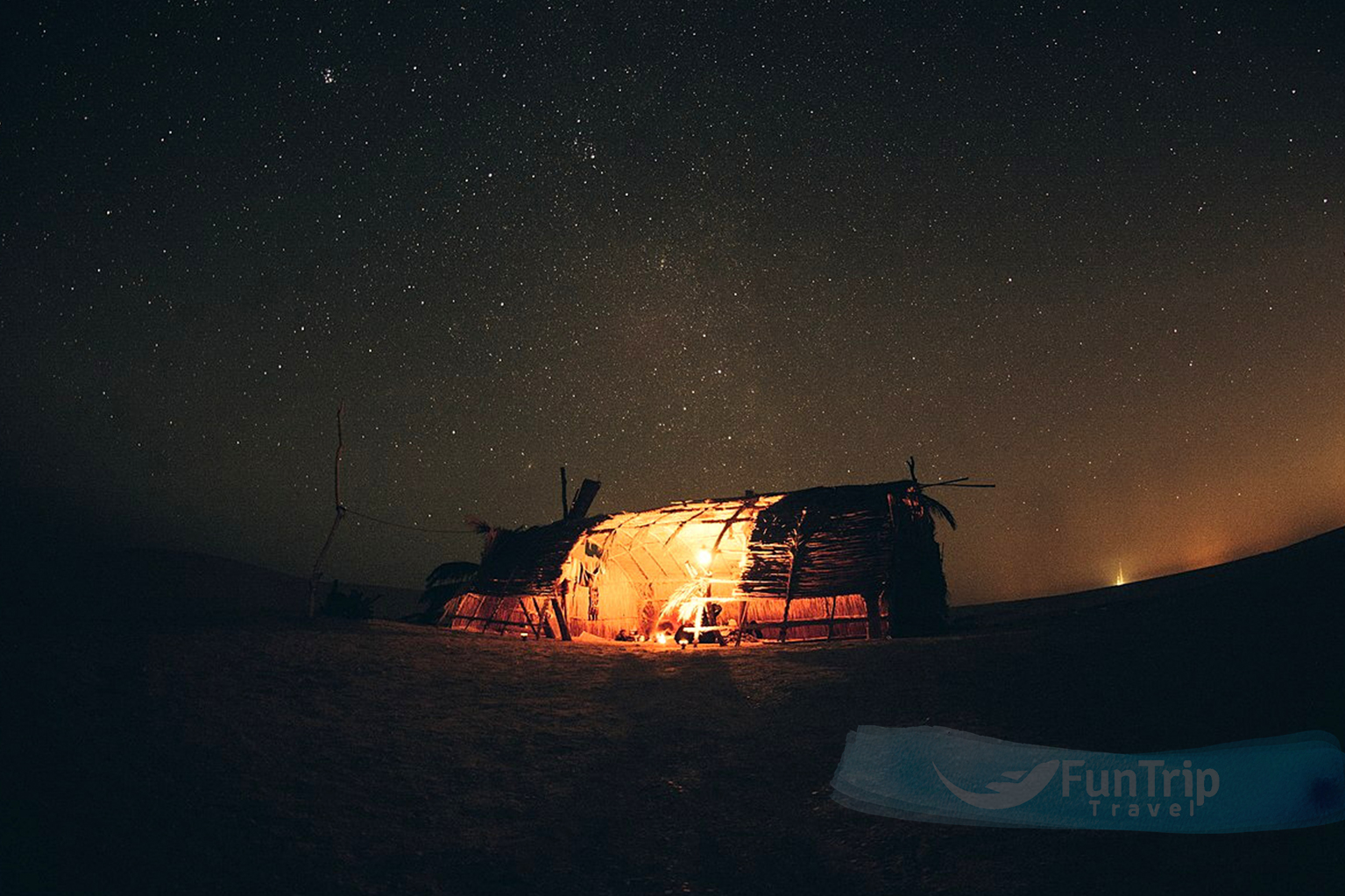
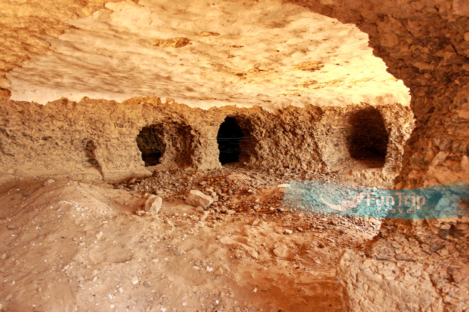
The Abu Leifa Monastery is carved into the mountain in Fayoum; discover authentic desert adventure with Real Fayoum. According to the inscriptions, it was founded in 686 AD by St. Panoukhius. The monastery was in use from the 7th to the 9th centuries.
It served as a safe haven for Christians fleeing persecution. A similar series of small man-made caves can be seen on the cliff face of the upper portions of the Deir Abu Leifa member’s giant cross-bedded sandstone immediately behind the Qasr El Sagha temple. The monastery is very primitive; its entrance is cut into the mountain and consists of small caves carved into cliff sides that can be difficult to reach. This monastery is not inhabited, but it is the best example of how ancient monasteries appeared before they were developed into modern-looking structures.
Deir Azab
Discover an authentic desert adventure at Deir Azab.
Also known as the Virgin Mary’s Monastery, is located 6 kilometres south of Medinet El-Fayoum. It is regarded as one of the most important monasteries in Fayoum because it is the final resting place of Anba Abraam, the favourite bishop of Fayoum and Giza from 1882 to 1914. Peter, the bishop of Fayoum, constructed this monastery in the 12th century. Very little of the original 12th-century structure remains.
The monastery has five churches, but the two main ones are Abu Seifein, a modern church that houses the remains of the Fayoum Martyrs and other martyrs, and Al-Fayoum, a traditional church. Some of the original structure, which dates back to the 12th century, can still be found in the Virgin Mary Church.
Dimieh El Sebaa
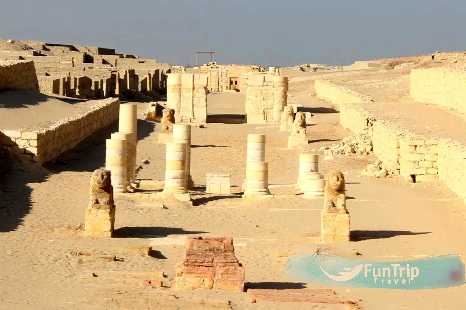
Is a Greco-Roman city founded by Ptolemy II in the third century B.C. on the shores of Lake Moeris. It was like a frontier, inhabited for six centuries before being abandoned in the mid-third century. The ruins include two temples, houses, underground chambers, streets, 10-meter-high walls, a Roman cemetery 900 yards southwest of the city, and agricultural fields separated by long irrigation canals. Goods from the Fayoum were transported across the lake by boat to be unloaded at the docks of Demieh, stored, or carried up the Avenue of the Lions.
Soknopaiou Nesos, known as Dimeh-al-Siba, is located 8 kilometres south of Qasr-el-Sagha and is thought to have been built on the foundation of an ancient settlement during the Ptolemaic Period. Archaeologists Giovanni Battista Belzoni and Karl Lepsius were the first to describe the ruins of complex structures towering above the desert plain. The “Crocodile Island” complex spans 640 metres in length and 320 metres in width from north to south, with the main object, the Temple, located in the southern part of the “island” and surrounded by white brick walls. A road paved with limestone blocks runs from the southern entrance to the Temple compound, near the RAT complex, to Moeris Lake. The town’s mudbrick walls can be seen from a long distance away, and the site is littered with debris and potsherds.
Qasr el-Sagha Temple
Is a small, uninscribed temple located above the northern shore of Birket Qarun, in a now deserted and inhospitable area at the foot of the desert escarpment towards Gebel Qatrani. Scholars disagree about its date, but its design suggests it was built no later than the Middle Kingdom. It was built with limestone blocks of various sizes that fit tightly together without mortar and with oblique corner joints. The interior has seven small chambers or shrines, as well as an offering hall and a “blind room.” There are several prehistoric village sites on the flat plain to the south of the temple, and tombs containing evidence of ancient Egyptian cult practise were discovered.
QATRANI MOUNTAIN
Do you enjoy hiking? Fayoum has prepared a trail for you. A true desert adventure? Qatrani Mountain is a 350-meter-high sandstone peak that serves as a landmark for visitors and hikers in Fayoum.
WIDAN EL FARAS BASALT QUARRY
Is a large black basalt quarry located on the northern edge of Gebel Qatrani, near the two prominent buttes. It was once an Old Kingdom quarry and is now known as the source of basalt used in the construction of the Old Kingdom pyramid temples. The quarry’s western and eastern sections are separated by 0.5 km, and both have an excavated bench on top of and along the edge of the Gebel el-Qatrani escarpment. Hundreds of blocks of basalt that were extracted are still present in a storage area near the quarries and in the harbour area near the now almost dried-out Fayoum Lake. The quarries, storage area, and harbour are linked by an unusual piece of archaeology: a 12 km-long paved road.
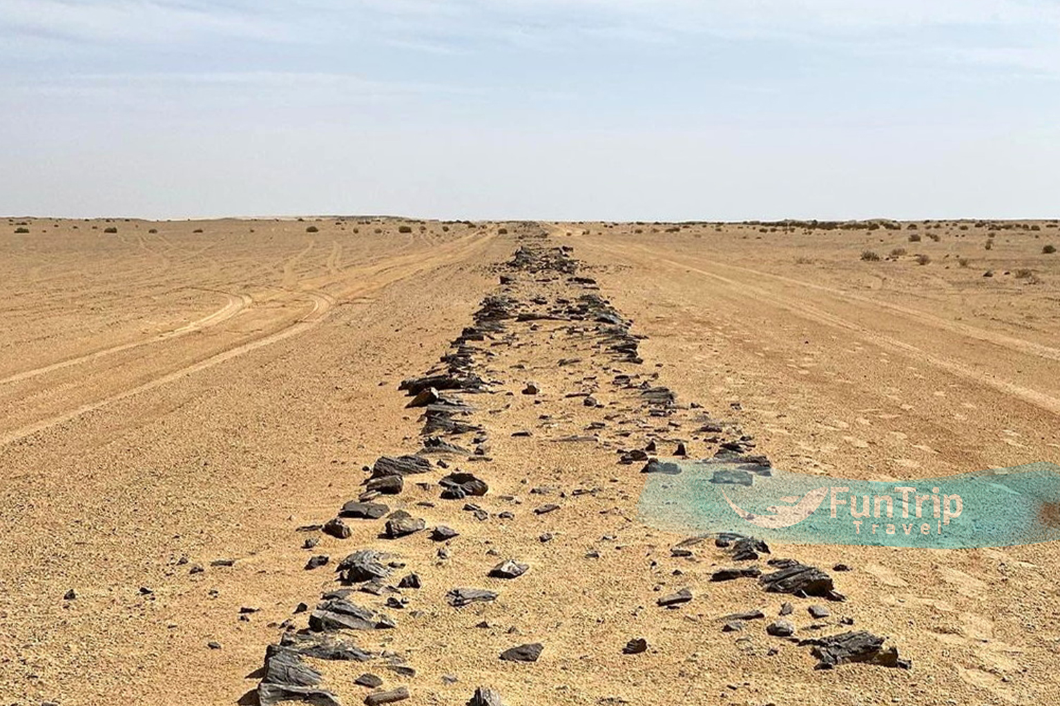
WORLD’S OLDEST AVED ROAD
The world’s oldest paved road is the Qasr El Sagha temple road to the ancient basalt quarries of Widan El Faras, which is said to be Neolithic in age. It is constructed of dry-laid, unshaped pieces of whatever stone was available at the time and has a total length of 12 km, with the last ten kilometres following a nearly straight and mostly downward path. It is partially elevated above the desert due to relative wind erosion, estimated to be 3 cm per century.